
Precision engineering for Nepal's next generation of works.
Engineering and Educational Services (P) Ltd delivers survey, design, and study assignments that hold up in the field — from river basins and highway corridors to hydropower sites and hazard-prone slopes.
Sectors we work in
- Hydropower
- Roads & bridges
- Water resources
- Irrigation
- Survey & LiDAR
- GIS & remote sensing
- Geohazard
- Glacial hazard
- Established
- 2007
- Professionals
- 20+
- Practice areas
- 15
- Public agencies
- 15+
A Lalitpur consultancy with national field reach.
Multi-disciplinary Nepali consulting firm providing engineering, planning, survey, design, construction supervision, and educational services since 2007.
“Providing Quality Engineering and Educational Services for the Construction of a New Nepal.”
- Six engineering divisions
- Water resources, research and planning, transportation, geotechnical, environmental, and administration.
- An Educational Department
- Training, seminars and capacity building tied to live projects and national skill needs.
Fifteen disciplines, one delivery standard.
Each practice combines field survey, analysis, and documentation that agencies can procure and build from.
- 01
Hydropower & Energy
Detailed feasibility of small hydropower projects, micro-hydro inventory and design, electrification studies, and survey and design of transmission and distribution lines.
- 02
Roads, Highways & Bridges
Transportation planning studies, detailed engineering survey, design and cost estimate of roads and bridges, pavement condition evaluation, and construction quality supervision.
- 03
Water Supply & Sanitation
Survey and design of rural water supply and sanitation systems, construction supervision and post-construction evaluation, and financial viability studies of water supply schemes.
- 04
Water Resources Assessment & Development
Engineering and agro-socio-economic studies, field surveys, hydrological data collection and analysis, water resources assessment, and identification and development of water resources.
- 05
Irrigation & Drainage
Planning and system design, crop water requirement and drainage runoff estimation, detailed design of canals, headworks and flow-control structures, and O&M programme preparation.
- 06
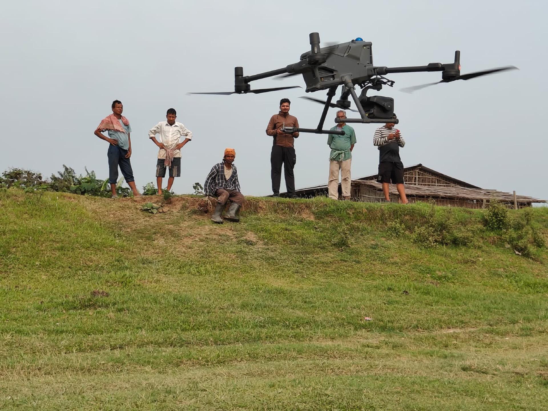
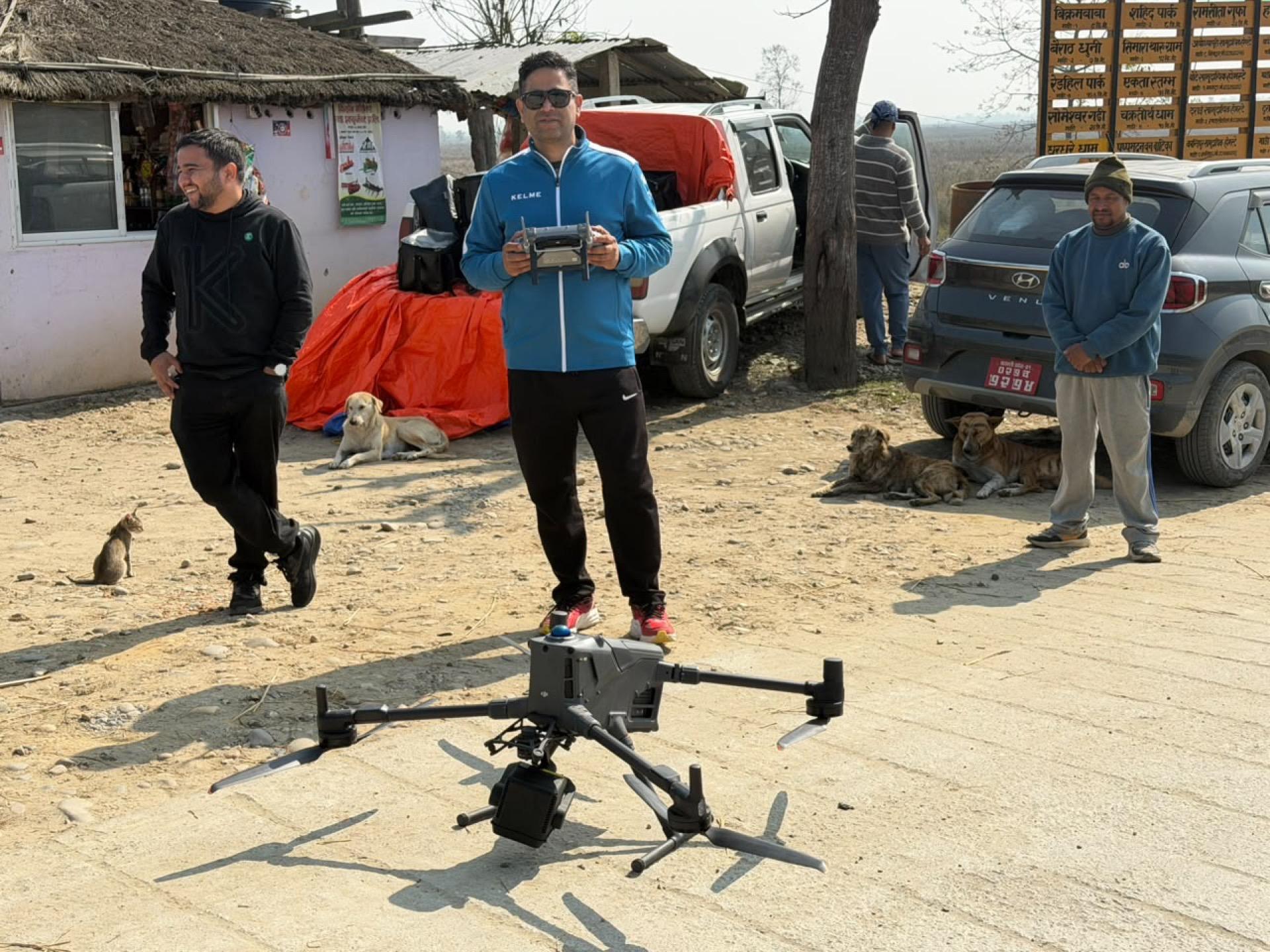
Land Survey, Drone & LiDAR Mapping
Topographic survey and site mapping for roads, bridge sites, irrigation command areas and structures, infrastructure alignments, and foundation stability and settlement monitoring.
- 07
GIS, Remote Sensing & Spatial Databases
Multi-hazard GIS database development, satellite and UAV-based terrain and glacier mapping, DEM and DTM generation, hazard and risk-zone map production, and web-based GIS platforms.
- 08
Planning, Design & Supervision
Transportation master plans (DTMP, MTMP), urban and land-pooling planning, landfill site planning, environmental and energy planning, and construction planning and scheduling.
- 09
Engineering Geology & Geohazard Mapping
Regional and site-specific geological mapping, inventory of historical landslides, debris flows and rockfalls, geohazard classification, and terrain stability and susceptibility analysis.
- 10
Geotechnical Investigation & Dam Safety
Subsurface investigation planning including boreholes and geophysical survey, slope and foundation stability analysis, and risk-informed design recommendations for dam safety.
- 11
Seismotectonic & Neo-tectonic Studies
Regional seismotectonic assessment, neo-tectonic and active-fault analysis, interpretation of seismic hazard data for dam and hydropower structures, and seismic microzonation inputs.
- 12
Hydro-Meteorological Studies
Analysis of rainfall, temperature and discharge data, hydrological hazard assessment including floods and GLOF surges, design flood and PMF estimation, and station network review.
- 13
Cryosphere & Glacial Hazard Assessment
Inventory of glaciers and glacial lakes from satellite imagery, glacial lake hazard ranking, field verification by bathymetric and topographic survey, and long-term monitoring recommendations.
- 14
Climate Change & Scenario Analysis
Downscaling and application of climate projections, assessment of hazards under current and future climate conditions, and climate-resilience and adaptation recommendations for infrastructure.
- 15
Training & Capacity Building
Project-related technical training, community technician and foremen programmes, water quality and construction skill workshops, and custom organisational capacity programmes.
Assignments that prove the method.
Recent work across hydropower, irrigation, water resources, precision survey, transport corridors and geotechnical investigation.
Chosen by the agencies that build Nepal.
We work with government departments, authorities, municipalities, development programs, and hydropower developers.
Professional membership
e2services is a registered member firm of the Society of Consulting Architectural & Engineering Firms Nepal — the national body of consulting architectural and engineering firms.
Check the public register- Department of Local Infrastructure Development and Agricultural Roads (DoLIDAR)
- Department of Irrigation
- Department of Energy
- Nepal Electricity Authority and hydropower developers
- Department of Roads
- Department of Water Supply and Sewerage
- Department of Agriculture
- Water and Energy Commission Secretariat
- Metropolitan cities and municipalities
- Ministry of Urban Development / Housing & Physical Planning
- Civil Aviation Authority of Nepal (CAAN)
- Department of Hydrology and Meteorology (DHM)
- Alternative Energy Promotion Centre (AEPC)
- Nepal Army — Directorate of Development & Construction
- District and provincial development committees
Instruments matched to the terrain.
VTOL mapping, LiDAR payloads, multi-frequency GNSS, total stations, and seismic kits — supported by GIS and engineering software.
- survey
Wingtra One Gen II (VTOL)
PPK large-area mapping UAV
1 set
- survey
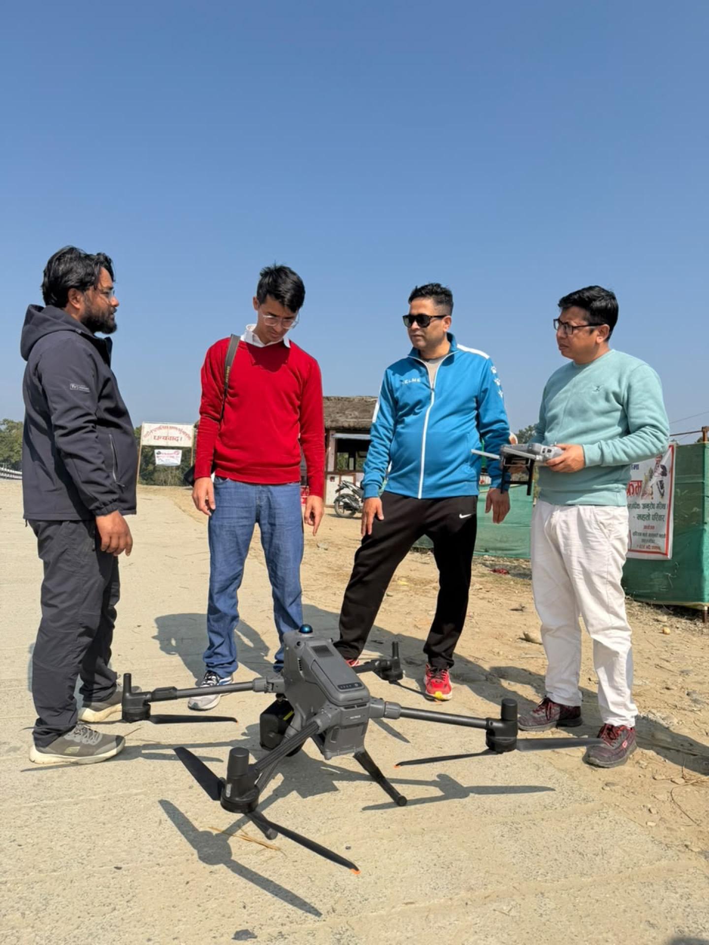
DJI Matrice 400 RTK
Enterprise UAV with intelligent battery station and Zenmuse L3 LiDAR module
1 set
- survey
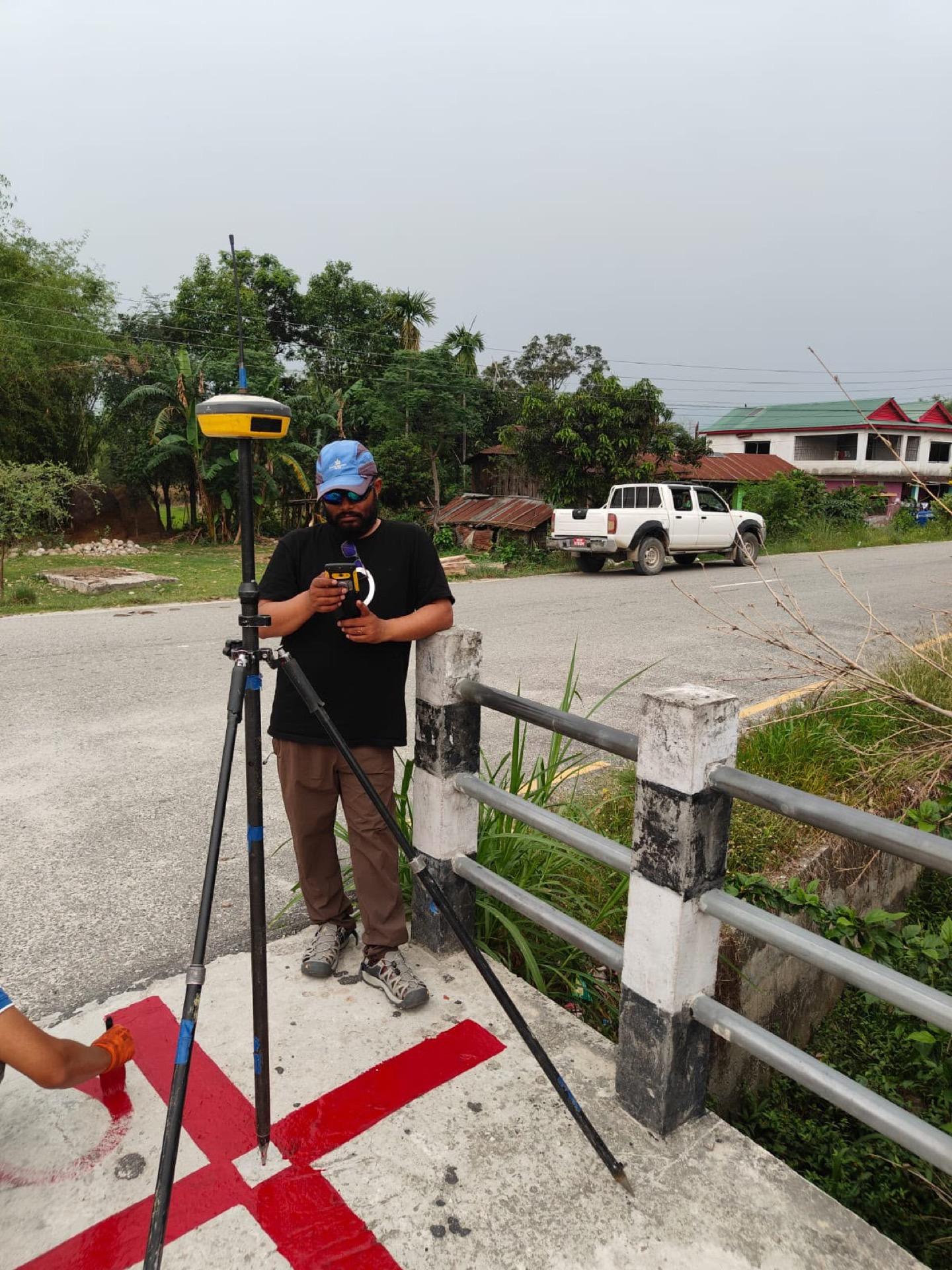
Stonex S900A GNSS
Multi-frequency DGPS / GNSS
1 set (3 units)
- survey
E-Survey E600 GNSS
DGPS / GNSS receivers
2 sets (4 units)
In the field
Trained crews, calibrated instruments, documented procedures.
Need a survey, a design package, or a multi-disciplinary study team?
Tell us about the corridor, basin, or facility. We will respond with the right mix of engineering and field capability.